Urbanslate
Ganesh Ramachandran: Urban Designer, Planner & Placemaker


CENTRAL ANNAPOLIS ROAD SECTOR PLAN, Prince George's County, MD
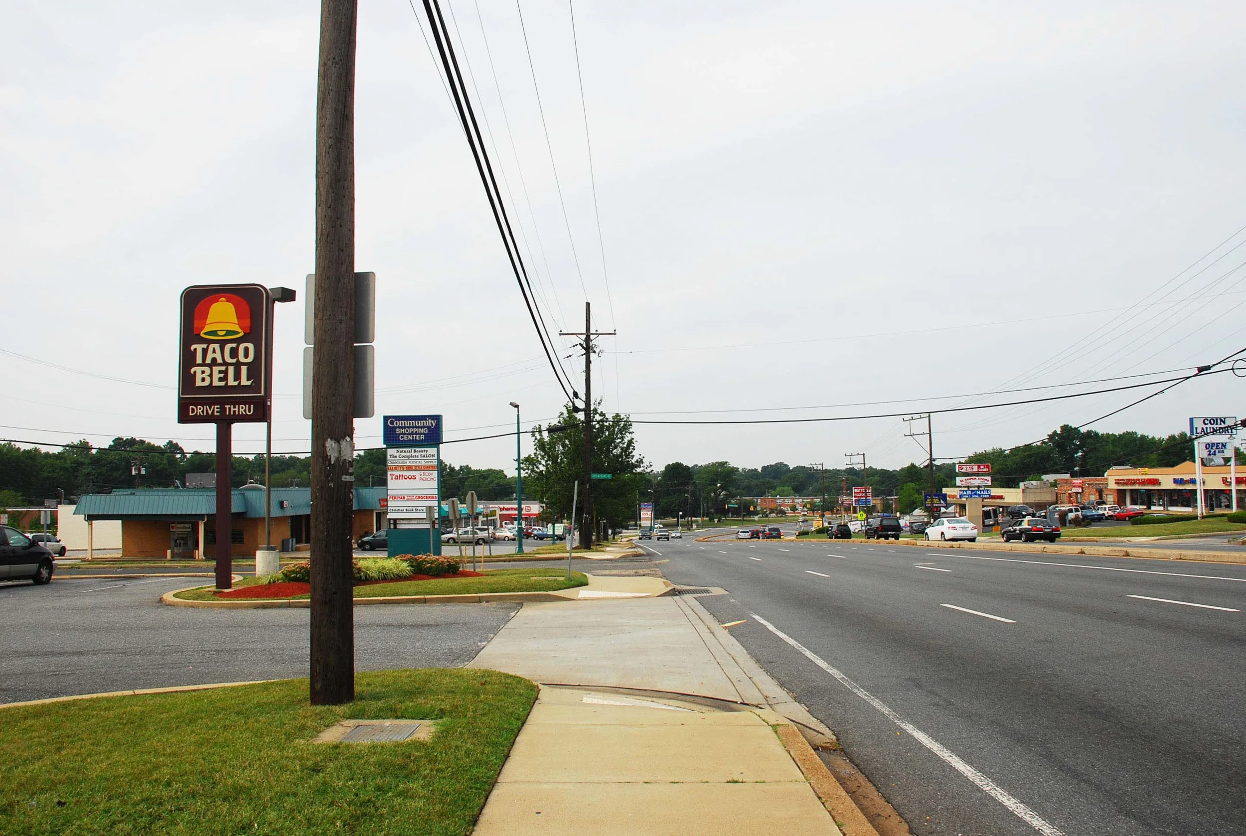
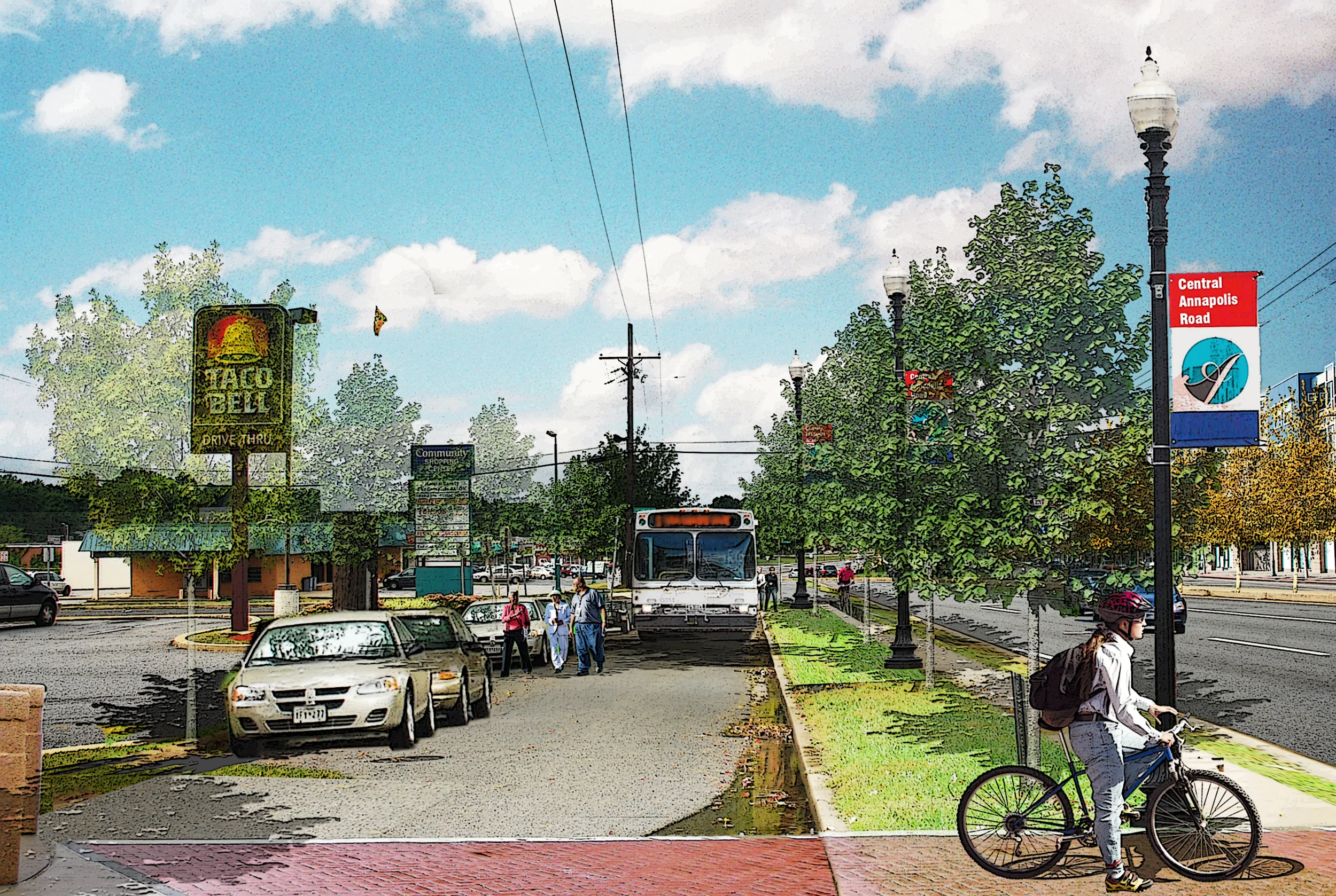
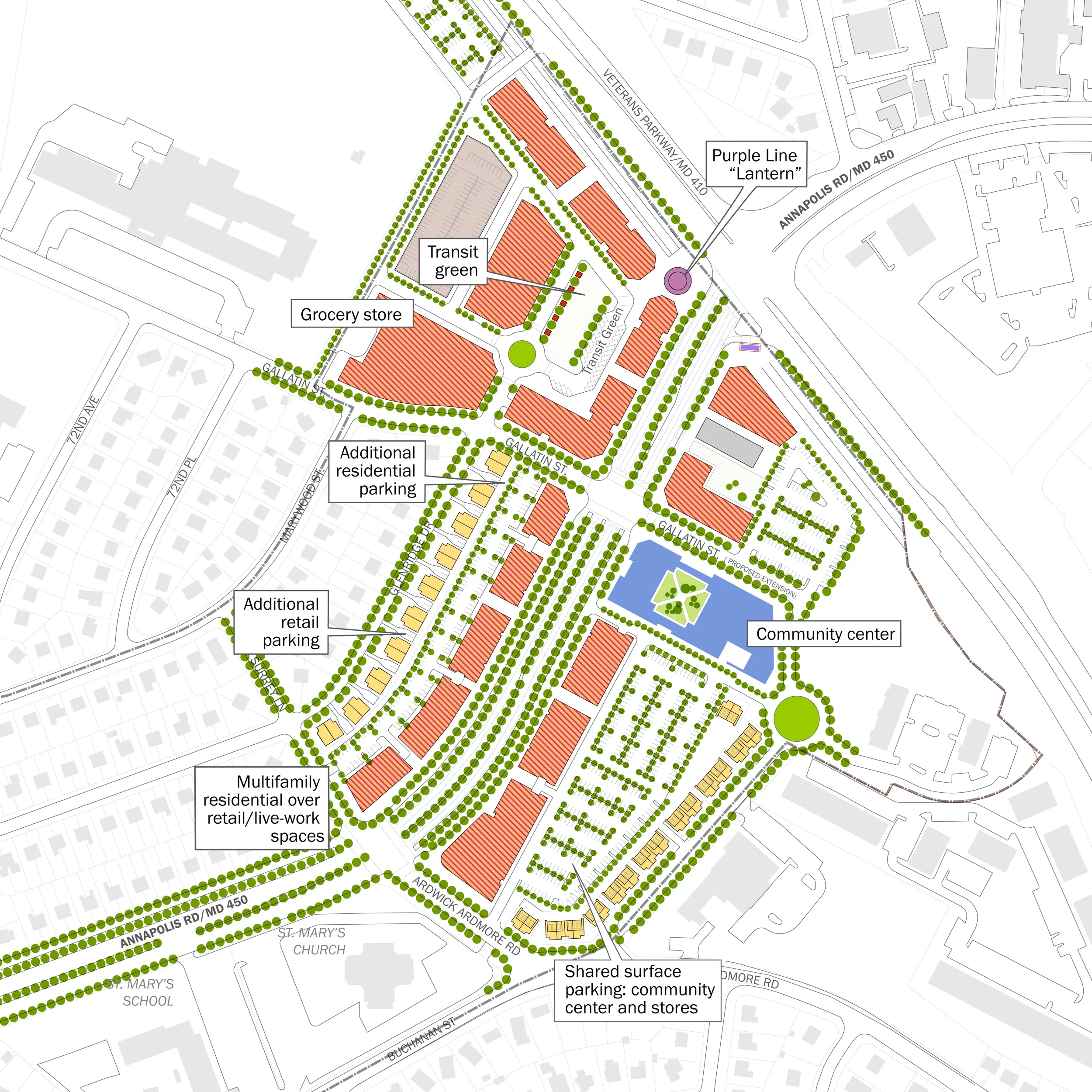
Annapolis Road is a 30-mile-long east-west arterial running from Annapolis through Prince George’s County to the outskirts of the District of Columbia. The sector plan focuses on a 1.77-mile, 250-acre segment of Annapolis Road with the goal of creating development and related zoning frameworks A major influence on the study’s process and recommendations has been a planned Light Rail Transit station – part of the new Purple Line connecting Bethesda to New Carrollton – to be located at the intersection of Annapolis Road and Veterans Parkway.
One of the key objectives of the planning process was to examine how the role of a state highway can be reconciled with the goals and aspirations of those for whom the surrounding areas constitute a real neighborhood. How do we transform a fleeting arterial into a memorable boulevard?
Completed at Goody Clancy Associates
Client: Maryland-National Capital Park and Planning Commission
Consultant Team: Goody Clancy, Robinson Associates, Kittleson & Associates, W-ZHA, Camiros, | Collaborators: Local residents and business owners, Maryland Transit Administration; the State Highway Administration; the Washington Metropolitan Area Transportation Authority;
Project Role: Site analysis, concept design, community workshop facilitation, consultant coordination, master planning report